Alamo Lake
“Mud Cliffs”
Around 8:45 Monday morning we fired up Plan “B”

and left Quartzsite with Becky and Dennis pulling their Fifth Wheel
 and Suzanne and Roy in their motor home pulling a trailer loaded with the two Rhino’s.
 We arrived in the Alamo lake area around noon and at a large turn out I pulled over so we could discuss where we wanted to camp. It was decided that Dennis and I would take the jeep and go look for camp spots in the desert. While we were gone Patti got a nice picture of some pretty pink clover like flowers.
 After driving around for about an hour we didn’t find any thing that would be suitable for all three rigs so when we got back it was decided to take the RV’s to the state park and see what was available there. We were lucky to find three sites near each other.
 so we set up, paid the rent, had lunch and after resting up for an hour, took a ride to the “Mud Cliffs“. There is an ATV trail that leaves the campground so we followed it until we got to a wash where we followed some tracks and after one wrong turn made it to the mud cliffs.
 Last year Patti and I tried to drive into a narrow canyon in the cliffs but only got a short distance before we came to a spot that we couldn’t get passed. This time we got past that spot and went about another two hundred yards but the canyon became too narrow to proceed
 so we parked and walked about a half mile into the notch.
 It is a very interesting place with arches,


 spires, overhangs and mud falls.


 We got back to the campground around 6:00 and were treated to a beautiful sunset.
 04-06-10 Alamo lake “Pond and Falls” Yesterday we went to find the waterfalls and ponds that Patti and I looked for last year. We left the camp ground around 9:30 and took Park road to the Wayside, headed south on Alamo rd, to Palmarita road where we turned east, followed it to High road and turned south. We continued south until we came to the big wash near the Pipe Line Ranch, where we turned east into the wash.
 The sand in the wash was very soft and the rigs had to work pretty hard to get through it. We drove up the wash for about a mile
and found a small road that took us to the first pond.
 From there we climbed through an arch
 to get to the bigger pond and waterfall.


We took some pictures and returned to the small pond where we had lunch.
After lunch we went to try and find the Anderson mine.
I was confused about which road we were on so we drove around for the next few hours and finally decided that we weren’t going to find the mine today.
We ended up at the end of the Alamo/Wickenburg road almost to highway 93.
While I was consulting the maps, GPS and laptop, Suzanne and Roy went off to do a little exploring. When they returned They told us that they had found a small lake so we followed them there.

The lake turned out to be a cattle “tank” (in the west any place that is made to hold water for live stock is referred to as a “tank“)
From there we went back to the main road and headed for home. Along this road there are lots of very large Joshua trees.

Some of the Joshua trees were berring fruit.

I picked one of the fruit and split it open to see what was inside. It was full of seeds.

There are also some large specimens of Cacti.
This one is a prickly pear.

Throughout the day Patti took some nice wildflower and cactus bloom pictures.


When we got back to the park, Patti and I drove down to the lake to get some pictures.

On the way we saw some wild burros.

We got back to the camp ground around 4:30
04-07-10
Alamo Lake
“Anderson Mine”
Normally when we go on a ride, we just wander around without any particular destination in mind. If we do have a certain goal, I generally know pretty much how to get there.
On Wednesday we went to the waterfall and ponds and had no problem finding it. I had also wanted to go to the Anderson Mine that same day but I got a little confused and we never got there.
Last evening, out of desperation, I tried something that I had never done before. I plotted the course on the Garmin Map Source map on my laptop and down loaded the route to my GPS.
This worked great!
All I had to do was follow the track on the GPS and it took us right to the Anderson mine. Cool!!
As we drove out the Alamo/Wickenburg road we saw a large rattle snake. When I first saw it, it was stretched out on the road. I was traveling at a good clip so we passed the snake and had to back up to get a picture. When we got back to it the rattler had assumed a defensive attitude which made for a better photo.

After every one had a chance to get pictures, we continued down the road and after another five miles we came to the trail, (as shown on the GPS) where we turned east.
About a half mile along the trail is Date Creek Well and stopped here to check it out.

At first it wasn’t obvious how the well worked.
We are used to finding wells in the desert with windmills attached to them. This one had a tall pole but no windmill. Instead it had a submersible pump with a short electrical cord with a plug on the end and a large metal tank.
I guess the rancher brings a generator out to the well now and then, plugs the pump into it and fills the tank.
There is a watering trough there with a toilet valve on it to keep it full.
We left there and continued east.
Along the way there were many beautiful Cactus and wildflowers for Patti to photograph.


The GPS track took us right to the Anderson Mine with out a hitch.
Anderson mine is a large open pit type diggings.
We stopped at the top so the rock hounds could collect rocks,
Here is a sample of the interesting rocks that they found.
There were some very small pretty flowers among the rocks for Patti to photograph.

Then we slowly drove down to the bottom of the pit.
We went up a small wash where we would have had lunch but there were so many stinging gnats down there that we decided to go to the top of the cliffs where there was a breeze to keep the no-see-ums away. In the short time we were in the bottom the gnats chewed up the back of my head and the tops of my ears.
While we were having lunch we could see what looked like an alternate way out of the mine.

At the lunch spot we noticed a diferent kind of Hedgehog cactus with yellow flowers.

When we were done eating we drove back down into the pit and up the other side.
After following some rocky steep trails we came back to the road out.
From Anderson mine we drove north until we came to Palmarita road we turned east and went to check out Palmarita ranch. The ranch is abandoned but the buildings are still standing in various stages of disrepair. As we pulled into the yard a horse and donkey came out of what had been the main house.

We walked around the area exploring the various buildings, then got back in our vehicles and drove down a narrow shady lane to the bank of the Santa Maria River.


The river is wide and about two inches deep but Roy tried to swim in it anyway.

From there we headed for the Wayside

where we had decided to stop for dinner and to fill the rigs with gasoline. The gas is in a large above ground tank in the back of the resturaunt.

While we were there we found out that due to the financial problems that the state is having[ they are planning to close the State Park campground at Alamo Lake.
It is hard to understand, why a state that depends on recreation and tourism for a large portion of there revenue is closing one of there most popular campgrounds and fishing lakes. The campsites at the lake run from $10 per night for tents to $25 for full hookups and the campgrounds are almost always full.
What’s next? close the Grand Canyon? Oh yeah, that‘s a federal park so for now it’s safe.
Well, that’s how politicians think. if there isn’t enough money coming in , punish the citizens enough so they will accept higher taxes.
We found out by talking to the Ranger at the campground that Arizona wants to get out of the park business all together.
It doesn’t look good for the future.
04-08=10
Alamo Lake
“Wandering around”.
Today we decided to try some trails on the west side of the highway that comes into Alamo State Park. There aren’t very many so we took the first one that we came to.
As it turned out the roads on this side all end a couple of miles from the highway at a wilderness area.
After poking around a little bit

we gave up and headed east to the Wayside and then drove north on the Alamo/Wickenburg road until we came to a trail going east.
We turned onto this trail and followed it across the desert, down some steep canyons into and across wide washes until we came to a wider road where we turned north and followed it until we came to The Santa Maria river wildlife area.
there we wound around and through thickets of brush and small trees on a very narrow path until we broke out onto a wide damp sandy wash which we followed until we came to the water.
Roy crossed the narrow tributary but the track didn't go very far on the other side so he came right back.
It was shady and cool by the stream
so we discussed having lunch there, until the gnats began their attack.
We got back in our machines and headed south on the wash until we got away from the water, trees and the gnats.
As we drove along I kept looking for a suitable spot for lunch.
Generally, shade is not very easy to find in the desert so you have to be open to any that you come across. We turned up a side wash that went into a narrow canyon in search of some place comfortable to stop for a while to rest and eat.
At the end of this wash we found what we needed; a rock overhang that provided enough shade and room for all of us to sit and have lunch.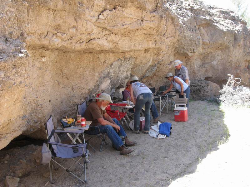
While we were there we heard a very loud buzzing sound going by our position. It turned out to be a swarm of bees looking for a home.
Fortunately they didn’t come into the wash where we were enjoying our lunch.
After lunch we headed back down the wash until I saw a trail going to the left and up the side of the canyon.
We followed it out of the wash and came to a crossing.
To our right we could see Palmarita road about a mile away. It was still early so I turned left and we continued climbing up the mountain. After a couple of miles the trail ended so we retraced our tracks back to the crossroad and turned left again. This track went through a few steep gullies and ended after about a mile.
When we came back to the crossing we were pretty much out of options so we decided to call it an early day, head for Palmarita road and stop at the wayside for drinks, then go back to the park to rest up and get ready to go back to Quartzsite tomorrow.
Along the way we stopped at an old abandoned ranch to check it out.
That evening we had a communal hotdog feed and sat around the campfire until all our firewood was burned up.
Friday morning we left Alamo Lake around 9:30 and arrived home around 11:45.
We had a good time at Alamo Lake but we are all ready for a day off.
No comments:
Post a Comment