05-21-10
White Rim Road trip.
05-18-10
We got a late start today and we had to go to the visitors center in Canyonlands Park to get our permit for the White Rim Road.
As we drove to the visitors center she Sky's were threatening rain.
">

From the visitors center we had to go back down highway 313 to Mineral Bottom Road where we turned left heading for the switchbacks and the White Rim. Mineral Bottom Road is a wide graded dirt road for about 12 miles
 then you come to the switchbacks down to Mineral bottom.
 As we started down the switch backs it began to rain. It only lasted for a little while.
At the bottom we came to a “T” where we turned right (north) and drove to the only boat launch on the Green River in Canyonlands Park.
 From there we headed south along the W.R.(White Rim) road. The first 25 miles of the road runs along the Green River
About five miles south of the “T” you enter the Park. After another 1.5 miles we turned east on the road that goes to a pair of spires called Zeus and Moses it is a side trip of about 6 miles,
 here we stopped for lunch.
 While we were having lunch we could hear thunder rumbling through the canyons.
After lunch we returned to the W.R. road and headed south again. Soon we came to the roughest part of the road north of Murphy’s Hogback but more about that later. This section is called Hardscrabble hill and is well named. The “Trail’ is very steep on both sides of the hill, very narrow and is covered with lots of large broken rocks. Unfortunately I don’t have any pictures of this part of the road.
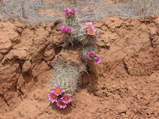
From the bottom of Hardscrabble to our camp spot at Potato Bottom the road is not too bad and we saw several cactus and wild flowers along the way.

 We got to the camp spot around 3:30. As soon as we started putting up our tent, the wind came screaming down the canyon and blew in gale force until we finally got the tent erected. In the process one of our fiberglass stretcher poles got broken and we sustained a rip in one corner of the tent.
 As soon as we finally got the tent erected and got inside exhausted from the effort, the wind stopped.
 After the wind died I went back out and by jerry rigging the side with an extra pole in place of the one that got broken, got that side of the tent stretched.
 For the rest of the day and through that night the winds were light.
05-19-10
We awoke to a nice morning with the remnants of clouds from the previous day storm moving away to the east.
 After breakfast we packed up and got on our way toward our next camp site at Airport camp, a distance of about 50 miles. The road to Candlestick camp was pretty good.

 The next obstacle was the climb up to Murphy’s Hogback. The trail here is narrow and steep with some overhangs that could be a problem for a pickup with a cab over camper on it. The only “bad” spot on the climb up Murphy’s is at the top where there is a large outcrop of rock in the middle of the road.
 Once at the top of the grade we stopped for lunch and enjoyed the incredible view.
 Some times a photo just doesn't do justice to the scene so we decided to try some video pans. here is one from Murphy's hog back.
The drive down the south side of Murphy’s is a steep grade and very narrow but not particularly rough. From the bottom of the south side of Murphy's grade, all the way to the Colorado River Overlook near the end of the White Rim Road about, 35 to 40 miles is very, very rough. It isn’t particularly challenging but it is very slow going do to all the “slick rock” that the road crosses.
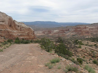
This is typical of the road between Murphy's and the Colorado River Overlook.

The speed limit for the W.R. road is 15 mph. and there are a few spots where you can actually achieve that speed but most of the time because of the rock, 2 to 5 mph is about all you can do. Even so the views are breath taking and worth the drive.


And of course there are the flowers.


in the following video you see what I call a desert garden.
By the time we got to Airport Tower we felt pretty beat up and we were spent.
We had planned to erect the tent but when I tried to drive a stake in the ground I found that the ground was solid rock with about a quarter inch of dust on top. Our tent requires 8 steaks to hold it up so we decided to just put down a ground tarp, set our cots up and sleep under the stars.

Sunset at Airport Tower camp.
 It was a clear night and the stars were beautiful. Around 3:00 in the morning I tried to get some star pictures but I guess our camera won’t do that.
05-20-10
I woke up at sunrise to the sound of something moving around our camp. It turned out to be just a Raven looking for scraps.

After taking a couple of sunrise pictures I went back to sleep for another hour or so.

I got up around 7:30 and had breakfast.
We packed up and left camp about 9:00.
We stopped several times to take in the views.


We stopped to see Musselman Arch.
I was very impressed by Patti who has a fear of heights and still walked out on the Arch so I could take a picture of her.

The next stop was The Colorado River Overlook.

From there we climbed The Shaffer Switchbacks.

looking down the Shaffer switchbacks.

We exited the park around 11:30.
By the time we got to Mineral Bottom Road where we started this trip we had covered 122 miles. The official distance for the White Rim Road is 96 miles.
Even though the ride was a little rough it was all worth it.
Here are some tips for any one who would like to take this trip.
First;
Make your reservations well ahead of time. You can’t make reservations before July 4th but I wouldn’t wait much later than that. We waited until mid February to make ours and as a result we were unable to get the camp spots that we wanted. Therefore on the second day we had to travel about 55 miles between camp spots. All camps on the trail are by reservation only.
Second;
I would suggest that if you want to make the trip in a counter clockwise direction as we did that you plan to camp at Candlestick campground the first night and Gooseberry camp for the second night. That way you won’t have that long, long drive on the second day. It would probably be about the same if you are making the trip in the clockwise direction.
Third;
Be sure to take along some insect repellant because the “No-seums’ are many and voracious. They are the size of dust motes with teeth like alligators. They attack in swarms from sunrise until dark. Fourth; Take a free standing tent. Most of the camp spots are in areas of solid rock so tent stakes won’t work. Fifth; This route is a favorite of “Mountain Bikers” so there are lots of bikes on the trail. Be careful and watch for swarms of bikes.
Sixth;
Take at least one gallon of water per day for two people and be thrifty with it. There is no water anywhere along the trail. We used about three quarters of a tank of gas in our Four cylinder jeep on this trip. I would suggest that you take extra gasoline just in case.
If your are a masochist you could make the trip in one very long 17+ hour day. I have spoken to people who have done it. I wouldn’t recommend it.
If you are a little less of a masochist you could make the ride in two days. If you really want to do this, I would suggest you get reservations to camp at ether White Crack which is about half way or Murphy's which has a great view.
I personally wouldn’t try this trip in any less than three days, four days would probably be best for ease and comfort, if you have the time.
We saw all kinds of vehicles on the trail.
Every thing from a big Dodge 4X4 with a cab over camper (I wonder how he did with the overhangs on the north side of Murphy’s grade) to a Lexus SUV and even a BMW.
I don’t know if the Beemer was four wheel drive or not. I hope so or he may still be there.
To sum it up. It was a good trip even with the long hard drives and trouble with the wind that first night. We will probably do it again sometime but not real soon. Next time I will know what to plan for and will get my reservations early.
Patti was very excited because she was able to get her Golden age pass.


